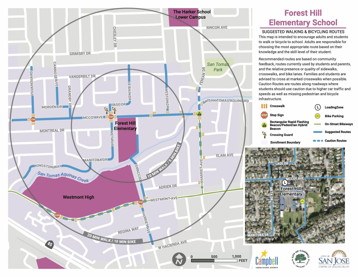
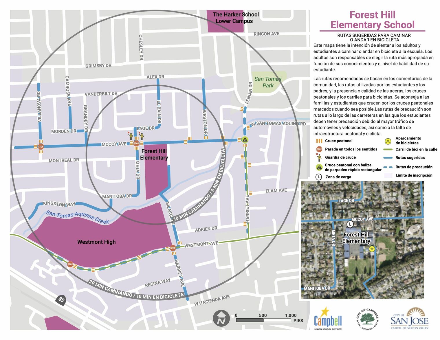
Please take this quick survey after reviewing the Safe Routes to School Maps. We value your opinion!
Survey in English encuesta en español
Overhead aerial photograph: McCoy Avenue and parking border the campus on the right; blue-roofed buildings surround a paved play area, with playgrounds and a field on the left.
Oblique aerial photograph: McCoy Avenue and parking are in front of the blue-roofed school buildings, with a paved play area and fields behind them.